
Latest Stories
The Motorway Valencia Never Built

I went to Valencia for a week a couple of years ago and fell for it completely.
It has the scale and energy of a big city. What it doesn't have is the edge. In London, Barcelona or Berlin some part of my brain is always on duty: watching my bag, watching the traffic, reading the street. In Valencia that switch never flicked on. It has the friendliness of a mid-sized city, the way Liverpool or Bristol feel, with a big city's culture and pace laid over the top.
And my favourite part of it wasn't the old town, or the beach, or the paella. It was the park.
A park that runs right through the middle of the city, below street level, for the best part of nine kilometres. People walk it, run it, cycle it. There are football pitches and a running track and outdoor gyms. Someone is always playing music. Kids climb over a 70-metre Gulliver. Groups meet for yoga, for five-a-side, for no reason at all. It's a place to breathe, right in the centre of a city of more than 800,000 people.

The Puente del Mar, finished in 1591, once crossed a river. Now it crosses a park - IMAGE CREDIT: PETE REYNOLDS / VELORUTION
It could so easily have been a motorway. It was supposed to be a motorway. The plans were drawn, approved and written into the city's masterplan. What follows is the story of how Valencians said no, and what happened after they won. I think it's one of the great urban stories of the last century, and hardly anyone outside Spain knows it.
A city built on a river that kept trying to drown it
The Romans founded Valencia in 138 BC on what was effectively an island in the Turia's floodplain: the river to the north, a secondary channel to the south. For most of the year the Turia is barely a river at all. It runs low and slow, and for centuries the dry bed was where the city went to enjoy itself. Easter picnics, livestock fairs, football leagues, all played out on the riverbed.
The rest of the time it was a threat. Valencia has flooded, badly and repeatedly, throughout its history. Engineers had been proposing to move the river out of the city since at least 1885. Plans were drawn up in 1900, 1939, 1946 and 1949. None of them were built.
14 October 1957
Then came the riuada.
It rained across the Turia basin for three days. At about four in the morning on 14 October the first surge hit the city: roughly 2,700 cubic metres of water a second, enough to flood the low-lying districts. People assumed that was the worst of it. Shortly after midday a second wave arrived, and it was far bigger. The official estimate at the time was 3,700 cubic metres a second. The river authority has since revised that to somewhere between 4,200 and 4,400. The channel through the city could carry roughly a third of it.
By most accounts around three quarters of Valencia went under. The water stood 40 centimetres deep on the Avenida Reino de Valencia and more than five metres deep on Calle Doctor Olóriz. In the Parterre gardens it reached 3.2 metres. Whole districts on the north bank disappeared under brown water. Natzaret, down by the port, was cut off entirely.
The official death toll was 81. Most historians think the real number was higher, possibly a lot higher. Around 4,000 families lost their homes and 13,000 lost everything they owned. The damage was put at 16 billion pesetas, at a time when the entire Spanish state budget was 43 billion. When Franco visited ten days later, the mayor, Tomás Trénor, confronted him about the slowness of the relief effort. Trénor lost his job. The aid, and the plan, sped up.

The Turia pouring through Valencia, 15 October 1957 - IMAGE CREDIT: UNKNOWN PHOTOGRAPHER, VIA WIKIMEDIA COMMONS (CC0)
Moving a river
Spain's answer was not to tame the Turia. It was to get rid of it.
A technical commission was set up in January 1958 and studied three options. Centro meant deepening and widening the existing channel through the city. Norte would have sent the river round the top of the city via the Carraixet ravine. Sur would dig a brand-new channel three kilometres to the south, from the Repartiment weir at Quart de Poblet to a new mouth at Pinedo, and abandon the old bed altogether. On 22 July 1958 the Council of Ministers chose Sur. It became known, and is still known, as the Plan Sur.
The numbers were enormous for a country still poor from its civil war. The new channel would run for 12.7 kilometres, 200 metres wide, engineered to carry 5,000 cubic metres a second. The state paid three quarters, the surrounding municipalities a fifth, the province the rest. Valencians themselves chipped in through a special 25-céntimo surcharge on every letter posted in the city from 1962 to 1971: the Plan Sur stamp. The budget started at 2,000 million pesetas and finished, by one reckoning, north of 7,000 million. Work began in the mid-1960s. Franco came to inaugurate the channel in 1969, and the last of the works were finished in the early 1970s. The Turia has flowed round the outside of Valencia ever since.
Which left a question no city in Europe had faced before. What do you do with a dry riverbed, twelve kilometres long and 160 metres wide, running straight through the middle of a major city?

Where the diverted Turia now meets the sea at Pinedo - IMAGE CREDIT: ENRIQUE ÍÑIGUEZ RODRÍGUEZ, VIA WIKIMEDIA COMMONS (CC BY-SA 3.0)
The plan: a motorway, obviously
You have to remember what year it was. London's Westway opened in 1970. Every planning department in Europe was drawing ring roads through Victorian terraces. A flat, empty, sunken corridor running east to west across a city, already below the level of the streets, already crossed by bridges, with not a single house to demolish. You couldn't have designed a better place to put a road if you'd tried.
And that is exactly what Valencia's 1966 masterplan did. Its own text is blunt. The diversion of the Turia, it says, "permits the creation of a broadly east-west fast-traffic road across the city... the old riverbed will be transformed into the road described." The bed was zoned as the "Madrid-Levante motorway". The drawings that followed between 1966 and 1969 showed a six-lane highway on the floor of the river, widening to as many as twelve lanes near Plaza de Tetuán, hard up against the medieval Serranos towers. A new central railway station and rail lines were to go into the bed as well, with the road running from the port to the airport.
The town hall was not being wicked. It was being normal. That's what makes what happened next so remarkable.
"The riverbed is ours and we want it green"
Some context first. Valencia in the 1970s was a city growing far faster than it could cope with: from 504,000 people in 1960 to 731,000 in 1975, most of them arriving from the countryside into hastily built estates with no tarmac and no facilities. Franco was dying. Neighbourhood associations, suppressed for most of the dictatorship, were becoming the way ordinary people organised. And Valencians had already won one fight. In 1974 the campaign El Saler per al Poble stopped the privatisation and development of the Saler dunes and pine forest south of the city.
That same year an architecture collective called Vetges Tu i Mediterrània published a counter-plan showing the old riverbed as a linear park. It was deliberately provocative, a "what if" to hold up next to the motorway. The local daily Las Provincias, until then a reliably pro-regime paper, went through what people still call its "spring" in 1973 and 1974 and began backing the green causes: the Saler first, then the river.
The trigger came on 1 December 1976. King Juan Carlos, on his first official visit to Valencia as head of state, signed a royal decree handing 1,193,217 square metres of the old riverbed from the state to the city, free of charge. It was presented as a gift. But read the small print and the land was ceded "to be used for the urban road network and for public parks". Roads first, parks second. And the gift stopped well short of the sea.
The slogan came straight out of that moment. Carmen Jordá, an architect at the heart of the campaign, put it like this to researchers decades later: "The king came and said he was going to give the river to the Valencians. What?! No. It has always been ours, and we want it green." El llit del Túria és nostre i el volem verd. It went on stickers, banners and walls, and you can still find it painted around the city today.
What followed was two years of extraordinarily well organised pressure, most of it concentrated in 1977, the year of Spain's first free elections since the 1930s.
- 21 March 1977. After a public meeting called by the Botànic neighbourhood association at the Sociedad Coral El Micalet, representatives of twenty organisations formed the Comisión Ciudadana Pro-Cauce, the citizens' commission for the riverbed. Its core were architects, civil engineers and ecologists: Just Ramírez, Miguel Gil Corell, Miguel Arraiz, Joan Olmos, Trinidad Simó and Carmen Jordá among them. They pulled in the professional colleges of architects, surveyors, engineers, lawyers, economists and doctors, the parents' federations and the city's two Ateneos.
- Easter 1977. Valencians have picnicked in the riverbed at Easter for generations. The commission turned the tradition into a demonstration: mass picnics and a kite festival under the banner el río para el que lo merienda, the river for the people who picnic in it.
- 20 April 1977. The commission delivered its formal petition to the town hall, backed by sixty organisations. It asked for four things: extend the land transfer all the way to the sea; strike the words "Madrid-Levante motorway" from the masterplan and rezone the entire bed as green space; draw up a plan of uses agreed with residents; and ban anything that would add noise or air pollution.
- 6 May 1977. The council gave way, at least in principle, voting to begin the process of designating the whole of the old bed as green space.
- 7 July 1977. A delegation put the demands to the King in person at El Puig.
- November 1977. The first "River Games", a programme of sporting events staged in the dry bed to make the point that the city had nowhere else to play. A horse fiesta in the river followed during Fallas in 1978.
- November 1978. The modification to the masterplan was approved. Every metre of the old Turia was now, legally, a public park.
Two years, from the decree to the rezoning. No occupation, no riot. Picnics, petitions, round tables, sports days and a very good slogan, backed by more than sixty organisations and a newspaper that had switched sides.
What strikes me most, reading the interviews the campaigners gave to researchers at Valencia's Polytechnic University forty years on, is who was involved. Carles Dolç, another of the architects, called it "interclassist": "there were people in this movement who were simply lovers of nature and of a city that respected its heritage". Joan Olmos, a civil engineer, remembers "a certain coincidence even with conservative sectors... some conservative media signed up to the idea". The river cut across class. Everyone had picnicked in it.
Winning was the easy part
Then came the harder argument: what kind of green?
In December 1978 the council launched a national ideas competition for the park. Thirteen teams entered. In November 1979 the jury declined to award a first prize at all, saying none of the entries exhausted "the enormous possibilities" of the site. The new democratic council, elected in 1979 under the socialist mayor Ricard Pérez Casado, then went over the heads of the local architects and engineers who had entered and hired Ricardo Bofill's Taller de Arquitectura, the Barcelona studio then at the height of its postmodern fame.
The campaigners hated it. Bofill proposed a formal, classical park: an "immense pine forest" structuring a sequence of gardens, with a grand geometric centrepiece of orange trees, palms and pools. The Pro-Cauce commission had backed a very different idea from the biologist Miguel Gil Corell: a bosque urbano, an urban forest, naturalistic and half-wild, closer to what the river had actually been. Gil Corell lost. "We were against Bofill's approach," Jordá said. "What we have now is better than what was there, but we wanted, and proposed, a riverbed that wasn't monumentalised."
Urban cycling news, honest stories, and a front-row seat as we rebuild Velorution from scratch. Free, every week.
Join 40,000+ following along
To its credit, the council put Bofill's plan on public show at La Lonja with comment forms, and the criticism landed. When the contracts were finally let in February 1985, Bofill kept only the two central sections beside the new Palau de la Música. The rest went to Valencian architects. Vetges Tu, the collective that had drawn the first counter-plan eleven years earlier, got the two westernmost sections. The special plan of 1983 divided the twelve kilometres from Mislata to Natzaret into eighteen sections, tramo I to XVIII, each bounded by a pair of bridges, each designed as its own piece.
The first sections opened in 1986. From there it came in waves.
- 1987. The Palau de la Música concert hall, by José María García de Paredes, opens on 25 April, looking out over Bofill's pools.
- 1990. The Gulliver: a 70-metre-long figure of the sleeping giant, tied down with ropes that double as slides and stairways, by the architect Rafael Rivera, the illustrator Sento Llobell and the Fallas artist Manolo Martín. Children have been climbing over him ever since.
- 1991 to 2005. Santiago Calatrava's City of Arts and Sciences fills the last built sections before the port: the Hemisfèric (1998), the Oceanogràfic with Félix Candela's concrete shells (2003), the Palau de les Arts opera house (2005).
- 2004. The Parque de Cabecera opens in July at the western end, with a lake and a lookout hill where the river once entered the city. The Bioparc zoo follows in 2008.

Gulliver, tied down since 1990 - IMAGE CREDIT: JOANBANJO, VIA WIKIMEDIA COMMONS (CC BY-SA 4.0)
Sixteen of the eighteen sections are done. The last two, where the bed reaches the sea at Natzaret, are still not. An international competition in 2007 picked designs by Jean Nouvel and the German studio GMP, and then the financial crisis arrived and the money went with it. Nearly fifty years after the rezoning, the campaign isn't quite over. At the 35th anniversary celebrations in 2022, the president of Valencia's federation of neighbourhood associations, María José Broseta, was still saying it: "This green river has to end at the sea. That's its natural destination."

The seaward end of the riverbed: Calatrava's Hemisfèric behind the València letters - IMAGE CREDIT: PETE REYNOLDS / VELORUTION
What it's actually like
Here's what the numbers say, and then what it feels like.
- About nine kilometres of continuous park, 160 metres wide on average, well over a hundred hectares. It accounts for roughly a third of all the green space in the city.
- Eighteen road bridges cross it, and more footbridges besides. The oldest, the Puente de la Trinidad, dates from the 15th century. The Puente del Mar was built in 1591 and closed to traffic in 1933. Three of the newest are by Calatrava.
- Pines, jacarandas, acacias, cypresses, holm oaks, olives, ash and willows. Whole stretches of sections VI and VIII were planted by residents themselves on annual Tree Day campaigns.
- Football and rugby pitches, an athletics track, a skate park, outdoor gyms, a signposted running route the length of the park, and a cycle path from one end to the other.
What it feels like is a city that has been given a second ground floor. You drop down a ramp from a busy street and the traffic noise falls away above you. You ride under the bridges rather than across them. Olmos, forty years on, calls it "the most important piece of urban planning of the last forty years in Valencia", and says what surprises him is "the diversity of social groups who use it. I'm thinking of immigrants, people from other countries, who have found a public space for their festivals." Dolç puts it more simply: "People walking, strolling, running, cycling. Every day of the year. Every trip across the city has to pass through the river."

Looking down into the park from street level. The traffic is up here; the city is down there - IMAGE CREDIT: PETE REYNOLDS / VELORUTION
That last line of Dolç's is the one that matters for anyone who cares about cycling. Because the park is sunken and continuous, it does something almost no piece of cycling infrastructure anywhere manages. It gives bikes and pedestrians a spine to the whole city, separated from every road, and it does it without taking a single lane from anyone. The road was never built.
It isn't perfect, and the people who fought for it are the first to say so. The eighteen sections were designed as eighteen separate pieces, and it shows: the park is a "puzzle", in the words of the Polytechnic's researchers, rather than the single wild forest the campaigners wanted. The City of Arts and Sciences end is far too paved and far too hot in summer. And on both banks run the fast roads that carry the traffic the riverbed motorway would have carried. "What about the edges?" Olmos wrote in 2007. "That's the motorway they didn't build in the bed, and it takes so much away from the park."

The Science Museum end: spectacular, and far too much paving for a summer afternoon - IMAGE CREDIT: PETE REYNOLDS / VELORUTION
The cycling city it made possible
I should be honest about one thing. Valencia's roads are not calm. The traffic on the big avenues is as heavy and as fast as anywhere in Spain, and it can be overwhelming if you're on foot trying to cross one at rush hour.
What makes the city work is that you almost never have to be in it. I spent my whole week there using nothing but Valenbisi, the public hire bikes, and I could get anywhere in the city on segregated lanes. Not painted gutters: proper kerb-separated paths with their own signals, joined up well enough that you rarely have to think about the route. Down a ramp into the river, along it, back up and onto a lane that takes you the rest of the way. It is one of the best cycling networks I have seen anywhere, and I've ridden in a lot of cities.
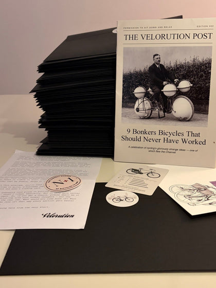
The Velorution Post
Real mail. Once a month.
We're all a bit digitally overwhelmed. So once a month I hand-pack an envelope and post it to you — a 16-page mini magazine, a letter, a collectable card. Things worth keeping, not junk through the door.

The Velorution Post
My pride and joy, through your letterbox
A 16-page mini magazine every month. No ads, just bicycle love. In the envelope with it:
- A letter from me
- A collectable trading card
- My real numbers, warts and all

Segregated lanes, their own signals, joined up. This is what a week on Valenbisi looks like - IMAGE CREDIT: PETE REYNOLDS / VELORUTION
Valencia is flat, warm and dense, so it always had a head start. But the Turia gave it something Barcelona and Madrid don't have: a car-free trunk route through the middle that existed before anyone had painted a bike lane.
Everything else grew off that spine. Valenbisi, the public bike-hire scheme, launched on 21 June 2010 with 2,750 bikes at 275 stations and had more than half a million users in 2023. The Anillo Ciclista, a protected cycle ring around the old town, was completed in 2017. The city's bicycle agency now counts 225 kilometres of bike lanes and 47 kilometres of cycle streets, plus nearly 23,000 bike parking spaces. The 2025 Copenhagenize Index rated Valencia the second-best city in Spain for cycling, behind only Vitoria-Gasteiz and ahead of Barcelona and Seville. In 2024 the European Commission named it European Green Capital, and the Turia gardens were a large part of the pitch.
You can ride from the Bioparc at the top of the city to the City of Arts and Sciences at the bottom without meeting a single car. In a city of 800,000 people. Try that in London.

Every trip across the city has to pass through the river - IMAGE CREDIT: PETE REYNOLDS / VELORUTION
October 2024
I can't write about this river without writing about what happened on 29 October 2024. Nobody in Spain talks about that night lightly.
A cut-off low, a DANA, stalled over the hills west of Valencia and dropped close to 500 millimetres of rain on the town of Chiva in about eight hours. That is roughly a year's rainfall. The water came down the Barranco del Poyo, a ravine that is usually bone dry, towards the towns of l'Horta Sud. The last reading the gauge managed before it was destroyed, at 18:55, was 2,282 cubic metres a second. Then it stopped reporting. More than 220 people died in the province of Valencia, most of them in Paiporta, Catarroja, Sedaví, Alfafar, Benetússer, Massanassa, Aldaia and their neighbours. Many died in garages and ground-floor flats, in the dark, with no warning.
The new Turia channel, the one the Plan Sur dug in the 1960s, ran close to capacity and held. Not a drop reached the old riverbed or the city centre. The park was untouched. In that narrow sense the engineers of 1958 were vindicated. The thing they built to stop 1957 happening again stopped it happening again.
But look at a map of where people died. Seventeen of them were inside Valencia's own municipal boundary, in La Torre, Castellar-l'Oliveral and Forn d'Alcedo. Every one of those districts sits south of the new channel. The great concrete trench, and the elevated V-30 ring road that runs beside it, protected the historic city by acting as a wall. The water that could not cross it stayed on the far side, in the towns. Valencia's own council has since said the Plan Sur needs "rethinking" in the light of what happened. The argument about who the diversion protects, and at whose expense, is not finished. Anyone who tells you the Turia story has a tidy ending hasn't been paying attention.
What I take from it
Four things, mostly.
- The default was a road. It usually is. Nobody in Valencia's town hall was a villain. They were doing what every city in Europe was doing in 1966. The alternative only existed because a few hundred people drew it, argued for it and made it impossible to ignore.
- It took two years to win and nearly fifty to build. And it's still not finished. If you're campaigning for a bike lane in Britain and it feels slow, take heart. Cities work in generations.
- Winning the principle isn't winning the design. The campaigners got their park and lost the argument about what kind of park. They still think that matters. They're right.
- Nobody had to give anything up. That's the part I keep coming back to. Valencia got a nine-kilometre car-free spine through its centre without closing a single road, because the road it displaced was never built. Most cities don't get a gift like that. Valencia nearly threw it away.
I've written before about how Paris rebuilt itself around the bicycle in fifteen years, about what Barcelona's numbers actually show, and about the year bike lanes started winning elections in London. Valencia belongs in that company. Its transformation just started fifty years earlier, in a dry riverbed, with a picnic.
If you go
Ride it end to end. Start at the Parque de Cabecera by the Bioparc and head east. The City of Arts and Sciences is about an hour away at a dawdle, and you will want to dawdle. Valenbisi stations line both banks. A week's pass is what I used, and I never once wished I had a car.

Hire bikes at the City of Arts and Sciences. Nobody arrived by car - IMAGE CREDIT: PETE REYNOLDS / VELORUTION
Sources
- Portalés, Palomares & Sosa (UPV), "Transformación urbana por movilización vecinal: recuperación de la memoria del Jardín del Turia", Biblio3W, 2020 — the chronology of the campaign and the interviews with Carmen Jordá, Carles Dolç, Joan Olmos and Amando Llopis
- Real Decreto 2763/1976, Boletín Oficial del Estado — the transfer of the riverbed to the city
- Gran riada de Valencia, Wikipedia (ES) and UPV: Así se produjo la riada de 1957
- Valencia Plaza: El lado oscuro del Plan Sur — the three options, financing and the Plan Sur stamp
- Valencia Extra: La autopista en el Jardín del Turia — the 1966 motorway plans
- Colegio Territorial de Arquitectos de Valencia: El Jardín del Turia — Bofill's plan and the section-by-section build
- eldiario.es: 35 años del Jardín del Turia and FAAVV: El llit del Túria és nostre i el volem verd
- Jardins de València: Parc de Capçalera and Ajuntament de València: Parque Gulliver
- Agencia Municipal de la Bicicleta, Ajuntament de València and Valencia Plaza: Copenhagenize Index 2025
- Maldita.es: los datos de la Rambla del Poyo, El Salto: 17 muertos en las pedanías de València and El Español: replantearse el Plan Sur
Leave a comment (1)

Velorution Exclusive · October
Define Bicycle Mug
£18.00. One month only. Then it retires to the Velorution Vault and may never be seen again.
Get it before it's goneFrom the Collective


More stories


Massimo · 3 September 2026
The highlight of my stay there a few years ago, too. Wonderful place.